
The United Nations just told the world to stop teaching a distorted map.
Story Snapshot
- The United Nations General Assembly urged wider use of equal-area world maps, notably Equal Earth.
- The vote passed 164–1, with the United States opposed and six abstentions reported in coverage.
- Togo led the push for African states, with support from the African Union.
- The measure is nonbinding and does not ban the Mercator projection.
What the United Nations Actually Voted For
The United Nations General Assembly approved a resolution that promotes equal-area world maps in classrooms and public use, highlighting the Equal Earth projection by name. The text, as reported, frames this as a fix for area distortion that shrinks Africa and enlarges high-latitude regions on the common Mercator map. The measure signals a preference, not a legal command. No government must swap every map tomorrow. Publishers, schools, and agencies will make their own calls, but the United Nations put a heavy thumb on the scale.
The vote tally drew headlines. Reports say 164 nations supported the resolution, one voted no, and six abstained. Coverage identifies the United States as the lone “no.” That fact gives the story a clean conflict line. Togo, on behalf of African states, advanced the text and gained African Union backing. The pitch was simple: stop teaching a picture of the world that understates Africa’s true size and warps how people think about global scale and importance.
Why Projections Matter Beyond the Classroom
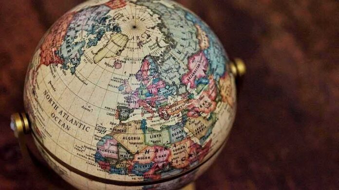
Maps compress a round Earth onto a flat page. Something always gets bent: area, shape, distance, or direction. The Mercator projection preserves angles, which helps navigation, but it inflates areas near the poles and shrinks regions near the equator. That is why Greenland can loom like a continent while Africa looks modest. Equal-area projections keep land sizes in correct proportion, which better reflects relative scale on a world map used for general understanding, not for steering a ship.
Equal Earth is an equal-area design meant for wall maps and textbooks. It shows Africa close to its true heft without turning shapes into strange blobs. Supporters argue this more honest picture helps students grasp trade routes, resource bases, and demographics with fewer mental traps. The point is not to grant Africa a political favor; it is to stop robbing it of visual weight. That claim aligns with common sense: size on a page nudges how we judge importance.
The American “No” and What It Signals
United States diplomats said the resolution pushed an ideological agenda and distracted from real crises of peace and prosperity. The statement mocked a debate about sixteenth-century mapping while wars and debt crush lives. That critique hits a nerve many voters share: focus on the urgent first. The same argument also warns against using the United Nations to launder culture-war projects in technical clothing. On prudence and priorities, that reads as a fair concern grounded in conservative values.
The UN General Assembly has voted to adopt a new world map projection that shows the size of Africa and other continents more accurately.
The “Correct The Map” resolution, sponsored by Togo and backed by African Union member states, received support from 164 countries. The… pic.twitter.com/tDuDLYWVtK
— Ⓝⓖ'ⓞⓡⓞⓡⓘⓔⓣ🐐🇰🇪 (@baroswahjr) September 5, 2026
But the content of the resolution stays narrow. It does not erase the Mercator projection from navigation or research. It does not tell publishers what to print. It urges better defaults for basic world maps where area accuracy matters. The United Nations bet that what children see shapes what they expect from the world. That is a modest, arguable step, not a bureaucratic takeover. If schools choose Equal Earth for wall maps, the sky does not fall; students just stop thinking Greenland rivals Africa.
What Changes Now and What to Watch
Expect slow, uneven adoption. Textbook cycles take years. Ministries will weigh costs. Map software firms may add Equal Earth templates, but few will flip global defaults overnight. The easiest near-term shift is in classrooms and media infographics. Those places set first impressions. If they switch, public mental maps shift. The test is simple: do more people correctly gauge where markets, food, energy, and people actually are? If yes, the resolution will have earned its ink.
Two cautions deserve a place on the desk. First, do not oversell this as a magic fix for bias. Maps can be fairer and still be used to mislead. Second, tools must match tasks. Keep Mercator in the cockpit. Use equal-area for world overviews. That is not ideology; that is using the right wrench for the bolt. If the United Nations sticks to that lane, publishers and parents should have little to fear and something to gain.
Sources:
diplomacyandlaw.com, newscord.org, english.aawsat.com, en.wikipedia.org, ctvnews.ca
© horizonpost.com 2026. All rights reserved.